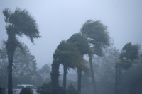
When Hurricane Michael barreled into the Florida Panhandle on Wednesday with 155-mph (249-kph) sustained winds, it defied forecasts made just two days beforehand, its wind speeds doubling since Monday and coming in just short of the highest category of intensity.
Michael was not the only tropical cyclone in recent years to undergo what scientists refer to as “rapid intensification,” defined as an acceleration of wind speeds of at least 35 mph (56 kph) in 24 hours or less. The phenomenon has become more serious as sea waters have warmed with climate change.
“It is most likely that the very warm water in the Gulf ... is likely contributing to the intensity and the intensification that we have seen,” said Jim Kossin, an atmospheric scientist with the U.S. National Oceanic and Atmospheric Administration.
Rapid intensification is dangerous because it gives businesses, industry and people on the ground less time to take appropriate precautions ahead of hurricanes like Michael that hit shore with far more furious winds than originally expected.
Several factors can contribute, but warmer waters increase the potential for a storm becoming stronger, climate scientists have said.
Climate change means that warmer ocean temperatures are being seen more often, said Jennie Evans, a professor of Meteorology at Pennsylvania State University.
Read more at Warm Gulf Waters Spawned Hurricane Michael's Intensity: Scientists

No comments:
Post a Comment