A look back at the country’s most disastrous weather of 2016.
The past year was scorching hot, freezing cold, soaking wet and consumed in flames ― and it’s just a sneak peek of what’s to come if we don’t change our course on energy, scientists say.
Some of climate change’s more dire potential effects ― cities submerged by rising sea levels, accelerated mass extinctions, a ruined global economy ― haven’t happened yet, at least not in a way that feels immediate to our daily lives. But more intense and more frequent extreme weather is a consequence we’re experiencing right now.
Here are some of the biggest climate events the U.S. experienced in 2016:
A massive blizzard battered the East
The year kicked off with a January blizzard that set multiple snowfall records in the East, covering about 434,000 square miles in 26 states.
The event was the all-time biggest snowstorm in at least six locations, The Weather Channel found ― Allentown, Pennsylvania, with 31.9 inches; Baltimore-Washington International Airport in Maryland with 29.2 inches; Harrisburg, Pennsylvania, with 30.2 inches; New York City’s Central Park with 27.5 inches; New York’s LaGuardia Airport with 27.9 inches; and New York’s JFK Airport with 30.5 inches.
...
We experienced the summer of floods
Summer 2016 saw not one, but three “1-in-1,000-year floods,” a meteorological term used to describe floods that have only a 0.1 percent chance of occurring. The deadly incidents in West Virginia, Maryland, and Louisiana hit in quick succession and accounted for a full one-third of such floods in the U.S. since 2010, according to USA Today’s count.
The wet summer was part of an alarming pattern. According to the National Climate Assessment, the frequency and strength of intense downpours in the U.S. has gone up over the past three to five decades. The trend is particularly notable in the Midwest and Northeast, which since 1991 have experienced 30 percent more rainfall than the 1901-1960 average.
The higher temperatures across the U.S. and the rest of the world are allowing the atmosphere to hold more moisture, scientists say, giving what might have been routine storms a powerful boost.
The consequences of this summer’s downpours were staggering.
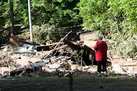
Flooding in West Virginia in late June killed at least 24 people and damaged more than 5,000 homes, making it the worst flooding event to hit the state in a century.
...
Just a month later, another 1-in-1,000-year flood hit Maryland, killing two people.
...
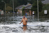
Finally, downpours that pummeled Louisiana in mid-August created the worst natural disaster to hit the U.S. since Hurricane Sandy in 2012, aid groups declared. The resulting floods killed 13 people, forced 30,000 citizens to evacuate and damaged at least 60,000 homes.
...
Arkansas, Mississippi, Tennessee, and Texas also experienced major flooding events between March and the end of summer.
Hurricane Matthew set unusual records
In October, Hurricane Matthew shattered records as one of the longest-lasting, strongest hurricanes of its kind and left a massive death toll in its wake.
Before Matthew struck the U.S. and claimed 46 lives in North Carolina, Florida, South Carolina, Georgia, and Virginia, it pummeled Haiti, killing more than 1,000 people there.
“The nearly unprecedented rapid intensification we saw with this storm is favored by warmer oceans and greater ocean heat content,” Michael Mann, a leading climate scientist and professor of meteorology at Pennsylvania State University, told HuffPost at the time.
A hurricane of Matthew’s force striking in October demonstrated the power of climate change to turn seasonal disasters into year-round threats. While hurricane season in the Atlantic runs from the beginning of June to the end of November, the statistical peak is Sept. 10, when ocean temperatures are high. But climate change is driving up temperatures during months that aren’t typically warm enough to support strong storms, and hurricane season is beginning to last longer.
Record-breaking heat gave us a glimpse into the future
With 2016 poised to be the hottest year on record, sweltering heat waves throughout the summer gave Americans a taste of what’s to come if temperatures continue to rise.
“If we continue with business-as-usual burning of fossil fuels, by mid-century what we think of as extreme summer heat today will become a typical summer day,” Mann, the Penn State professor, told HuffPost over the summer.
...
Wildfires raged in California and Tennessee
With ongoing drought and high temperatures drying up California’s forests and priming them for massive blazes, 2016 was another destructive wildfire season for the state.
In the first seven months of 2016, twice as many acres burned in the state than had burned in the same period the year before, the California Department of Forestry and Fire Protection told the Los Angeles Times.
The massive Soberanes fire that burned 132,127 acres near Big Sur for three months until October may have been the most expensive fire to fight in U.S. history, costing over $200 million to battle, The Associated Press reported based on data released by the National Interagency Fire Center.
...
More recently, a wildfire in Tennessee last month ranked as the largest fire in the state in 100 years. The massive blaze around Gatlinburg killed 14 people, forced 14,000 to evacuate, affected more than 2,400 structures, and caused over $500 million in damages.
Read more at This Year’s Extreme Weather Was One for the Books


No comments:
Post a Comment