Will Global Warming Make Hurricane Forecasting More Difficult?
Will Global Warming Make Hurricane Forecasting More Difficult? That’s the title and provocative premise of a new paper by MIT hurricane scientist Kerry Emanuel (early online PDF available here from the Bulletin of the American Meteorological Society.) Dr. Emanuel makes the case that the most dangerous storms—tropical cyclones that intensify rapidly just before landfall, catching forecasters and populations off guard, thereby risking large casualties—are likely to become increasingly frequent and severe as the globe warms, increasing from one such storm every 100 years to one every 5 - 10 years.
Tropical Cyclone Mortality Dominated by a Small Number of Events
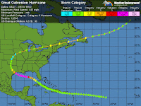
Since 1971, tropical cyclones (which include all hurricanes, typhoons, tropical storms, and tropical depressions) have killed 470,000 people (about 10,000 per year) and caused $700 billion in damage, according to the international disaster database, EM-DAT. Most of these deaths were caused by just a few storms—for example, three Atlantic hurricanes (the Great Galveston Hurricane of 1900, the 1928 Lake Okeechobee hurricane, and Hurricane Katrina of 2005)—caused 56% of all U.S. hurricane deaths since 1900.
Increased vulnerability due to growing coastal populations
In recent years, better tropical cyclones forecasts have resulted in reduced death tolls and lower damages than would otherwise have occurred. However, a large increase in coastal population resulted in an almost three-fold increase in the global population exposed to tropical cyclone hazards between 1970 and 2010 (Peduzza et al., 2012.) This helped fuel an increase in tropical cyclone damages of about 6% per year between 1970 and 2015, according to EM-DAT. Thus, much improved forecasts and/or major reductions in vulnerability though better preparedness and building codes are needed to avoid increasing tropical cyclone death tolls in the coming decades.
Poor intensity forecasts make us vulnerable
While track forecasts of hurricanes have improved by more than a factor of two over the past 20 years, intensity forecasts have shown little improvement. Dr. Emanuel gives four reasons for this:
- Very high resolution computer models are needed (1 km resolution or better), which are beyond the capability of modern computers to run economically.
- We have poor understanding of and models of the processes in the lowest few hundred meters of the atmosphere (the boundary layer).
- We have difficulty modeling how the top few hundred meters of the ocean responds to a storm.
- The process of taking observations that show a dramatic variation over short distances and correctly initializing a hurricane model with these observations is difficult.
The 2016 hurricane season gave us two humbling examples of how far we still have to go with intensity forecasts. As Hurricane Matthew drifted across the southern Caribbean Sea in late September, the hurricane rocketed in strength from Category 1 to Category 5 in just 24 hours (from 80 mph sustained winds at 03Z on September 30 to 160 mph at 03Z on October 1). The official NHC forecast at the start of this day-long burst was for Matthew to take three days to top out at high-end Category 2 strength (105 mph). Less dramatic but still eye-opening was Nicole’s surge from Category 1 to Category 4 strength in the Northwest Atlantic over just 21 hours (from 90 mph sustained winds at 06Z on October 12 to 135 mph at 03Z on October 13). Like Matthew, Nicole had also been predicted at the start of its rapid strengthening to remain just below the major hurricane threshold (Category 3). Dr. Emanuel gives an additional troubling example of a rapid intensification evert that was poorly forecasted: Hurricane Patricia of October 2015, which hit a relatively unpopulated portion of the Pacific coast of Mexico as a Category 4 storm with 150 mph winds after topping out as the strongest tropical cyclone ever measured—215 mph sustained winds. During a 24-hour period from October 22 at 06 GMT to October 23 at 06 GMT, Patricia intensified by an astonishing 120 mph—from an 85 mph Category 1 storm to a 205 mph Category 5 storm. During this same period, the National Hurricane Center predicted an intensification by only 35 mph. Dr. Emanuel notes, “Had the storm made landfall at the end of this period of rapid intensification, the result could have been catastrophic given the poor anticipation of the magnitude of the event.”
Read more at Will Global Warming Make Hurricane Forecasting More Difficult?

No comments:
Post a Comment